♫musicjinni

A Year of Weather - 2019

video thumbnail
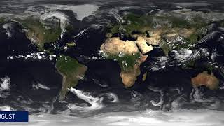
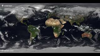
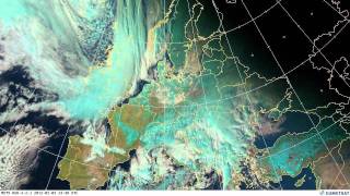
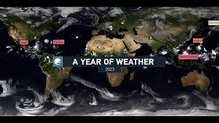
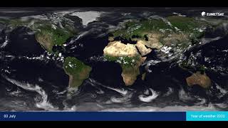
This visualisation, comprised of imagery from the geostationary satellites of EUMETSAT, NOAA, the CMA and JMA, combined with data from EUMETSAT's polar orbiting Metop satellites, shows an entire year of weather across the globe throughout 2019.

This ultra-high resolution (4k) visualisation has been produced by EUMETSAT's data visualisation team and is composed of a satellite infrared data layer, provided by MeteoFrance, superimposed over NASA's 'Blue Marble Next Generation' ground maps, which change with the seasons.

A Year of Weather - 2019

A year of weather 2022

Welcome to EUMETSAT 🛰️

Meteosat Instrumentation

Meteorology via satellite

Metop Second Generation A: METImage animation

Goodbye, Metop A

Use of Metop/EPS Programme data

EUMETSAT overview

Using Meteosat Third Generation data - Florence Rabier

Monitoring weather and climate from space

Satellites and storms

Meteosat Third Generation explained

Frozen Europe

EUMETSAT and Africa: an overview

Using Meteosat Third Generation data - Phil Evans

EUMETSAT Ground System

European weather June 2012

European weather July 2012

Using Meteosat Third Generation data – interview with FMI

European weather May 2012

A year of weather 2023

A Year of Weather 2020

European weather April 2012

EUMETSAT - Monitoring weather and climate from space

EUMETSAT’s future focus – a new era approaches

Meteosat Third Generation in Africa - Webinar

European weather October 2013

European weather September 2012

Using Meteosat Third Generation data – interview with TSMS

Disclaimer DMCA