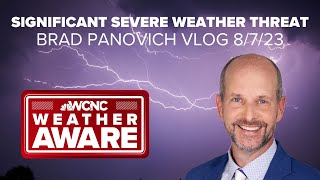
Significant severe weather risk in Charlotte, NC: Brad Panovich VLOG |

|
|
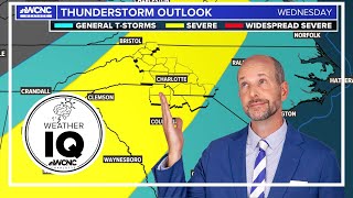
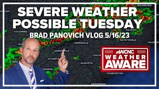
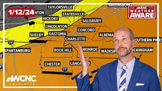
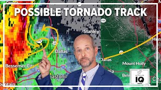
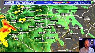
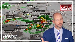
Brad Panovich severe weather VLOG 8/7/2023: A significant risk of severe weather will move into the Charlotte, North Carolina, region Monday afternoon. The primary threat will be damaging winds with the storms hitting the Charlotte metro after 5 p.m.
In this video, chief meteorologist Brad Panovich breaks down the timing of Monday's storms and looks at the biggest threats. As of now, North Carolina and South Carolina could see damaging winds over 60 mph, heavy rain, lightning, small hail, flash flooding due to heavy rain and spin-up tornadoes along the front. Panovich says the biggest risk is straight-line winds. "Wind, wind, wind is the issue," Panovich says. "Yes, there could be some isolated tornadoes, but wind is wind, folks." Brad Panovich says winds up to 80 mph during downbursts could cuause significant damage in the Charlotte region. Monday's damaging winds outlook is 45%, which is extremely rare, according to Panovich. Stay Weather Aware and have a plan for when severe weather strikes. #cltwx #ncwx #scwx #wcnc #wxaware #weather #charlotte #northcarolina #southcarolina Weather IQ is powered by the meteorologists and forecasters at WCNC Charlotte in North Carolina. This channel is dedicated to forecasting, explaining, and educating weather, climate, and atmospheric science to everyone, including teachers, students, and more. SUBSCRIBE TO THE CHANNEL: https://www.youtube.com/channel/UCAdmOVgQt4os407ftOzlHDg SEE THE WCNC CHARLOTTE WEATHER FORECAST ANYTIME: https://wcnc.com/weather GET SEVERE WEATHER ALERTS. DOWNLOAD THE WCNC CHARLOTTE APP: https://wcnc.com/appredirect |